


St. Clair Region Conservation Authority Wetland Regulation Policy
 In 2006, Regulations allowing the Conservation Authority (CA) to regulate wetlands, as defined, were approved by the province. Each Conservation Authority’s Regulation is based on Provincial Guidelines.
St. Clair Region Conservation Authority (SCRCA) staff drafted a wetland regulation policy, which outlines established, science-based protocols for regulating wetlands.
SCRCA’s wetland regulation policy was derived from the Conservation Authorities Act and Ontario Regulation 41/24 “Prohibited Activities, Exemptions and Permits”, and is consistent with neighbouring CA wetland regulation policies and Conservation Ontario approved guidelines.
SCRCA’s wetland regulation policy was approved by SCRCA’s Board of Directors on April 21, 2016.
Download SCRCA Section 28 Wetland PolicySelect an item to expand it’s contents.
From the provincially approved “Policies and Procedures for CA Plan Review and Permitting Activities”,
8.0 SERVICE DELIVERY ADMINISTRATION
8.1 CAs shall develop policies, procedures and guidelines for their municipal plan review activities and for CA Act S. 28 permitting activities (i.e. administration of the regulation and review of applications) with regard to the best practices outlined in this Policies and Procedures chapter. The CA documents should be approved by their Board of Directors and made available to the public.
The purpose of formalizing a wetland policy under the Section 28 Regulation is to provide:
- Transparency to applicants when proposals/enforcement are being reviewed/investigated in wetlands and their adjacent lands
- Consistency and clear direction in application review and enforcement
- Improved turnaround time as clear policy allows quicker staff decision making. By establishing guiding principles which pertain to wetlands as natural hazard features under the Regulation, the intent of policy is more clearly understood.
Under Section 28 of the Conservation Authorities Act, wetlands (as defined) are regulated by Conservation Authorities (CAs) via Ontario Regulations “Prohibited Activities, Exemptions, and Permits”.
As per Section 28 of the Conservation Authorities Act, wetlands must meet the following criteria to be regulated:
a) Is seasonally or permanently covered by shallow water or has a water table close to or at its surface,
b) Directly contributes to the hydrological function of a watershed through connection with a surface watercourse,
c) Has hydric soils, the formation of which has been caused by the presence of abundant water, and
d) Has vegetation dominated by hydrophytic plants or water tolerant plants, the dominance of which has been favoured by the presence of abundant water, but does not include periodically soaked or wet land that is used for agricultural purposes and no longer exhibits a wetland characteristic referred to in clause (c) or (d).
To receive permission for development within or adjacent to regulated wetlands, it must be demonstrated in an application to the satisfaction of the CA that the control of flooding, erosion, pollution, dynamic beaches or the conservation of land will not be affected, and/or the interference on the wetland is acceptable in terms of the natural features and hydrologic and ecological functions of the wetland.
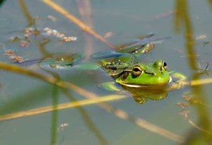
Wetlands are a precious resource. They moderate water flow by absorbing much of the surface water runoff from the land and then by slowly releasing it. This helps to reduce flooding and to sustain water flow during dry spells. They are also important for fish and wildlife habitat, recreation and tourism, water quality improvement, erosion reduction, and more.
However, wetland coverage in southwestern Ontario has decreased significantly in the past 200 years, going from 40 to 60% coverage in Lambton and Kent counties, to a current coverage of about 1% in the St. Clair Region.
To learn more about the history of wetlands in the St. Clair region, refer to the following presentation:
http://www.stclairca.com/scrca/downloads/WetlandEcologySlidesandNotes.pdf
The Ontario Ministry of Natural Resources and Forestry’s (MNRF) mandate is the protection and sustainable management of the province’s natural heritage features, including wetlands.
To aid in identifying those wetlands that have value at a provincial scale, MNRF has developed, and administers, the Ontario Wetland Evaluation System (OWES). The wetland evaluation process defines, identifies and measures wetland functions and values.
Wetlands are assessed based on their perceived values in maintaining natural processes (eg. groundwater storage and release, provision of habitat for wildlife species, ecosystem productivity and biological diversity). They are also assessed on the benefits provided to society (eg. flood damage prevention, harvestable product provision, improved water quality, recreational opportunities).
The system ranks wetlands relative to one another. They may be ranked as locally or provincially significant. Only individuals trained in an MNRF-approved course can evaluate wetlands using the OWES methodology and all wetland evaluations must be submitted to MNRF for review and approval.
You can use the interactive mapping tool MNRF Map to determine if you have wetlands on your property.
The provincial government is currently working on a discussion paper on wetland conservation in Ontario, which will guide the development of a strategic plan for the protection of Ontario’s Wetlands. The information can be found on the Environmental Registry: http://www.ebr.gov.on.ca/ERS-WEB-External/displaynoticecontent.do?noticeId=MTI1MzM3&statusId=MTg4ODE3&language=en.
If you have any questions about ‘SCRCA Policies and Procedures of Administration of Section 28 Regulations Wetland Policies’, please direct them to [email protected].
News & Blog
 St. Clair Region Conservation Authority Celebrates 2026 Conservation Scholarship RecipientsJuly 21, 2026
 TTLT and SCRCF Host Recognition Event at Bradshaw Conservation LandsJune 2, 2026
 Scholarships Available through the St. Clair Region Conservation AuthorityMay 1, 2026
 SCRCA Hosts A.W. Campbell Maple Syrup Festival March 21 – Alvinston Firefighters Association to Hold Pancake Breakfast March 21 and 22March 9, 2026
 St. Clair Region Conservation Authority Celebrates a Year of Environmental Progress at 2026 Annual General MeetingFebruary 27, 2026