


• About
    • Mission / Vision Statement
    • Governance / Board of Directors
    • Board Meeting Packages
    • Area of Jurisdiction
    • Publications/Forms
    • Events
    • Tender Documents
    • Employment Opportunities
    • Accessibility
    • News & Blog
    • SCRCA Staff Directory
    • Service Disruptions
    • Contact Us
  • Permits & Planning
    • Introduction
    • Property Inquiry
    • Map Your Property
    • Regulations Permits
    • Drainage Act Project Review
    • Plan Input and Review
    • Policies and Guidelines
    • Fee Schedule
  • Water Management
    • Flood Notices
    • Flood Notice Types
    • W. Darcy McKeough Floodway
    • Low Water Response
    • Riverbank & Shoreline Protection Development
    • Erosion Control Projects
    • Great Lakes and Connecting Channels
  • Watershed Services
    • Tree Planting / Woodlot Services
    • Environmental Monitoring
    • Habitat Restoration Projects
    • Grants for Landowners
    • Invasive Species
  • Conservation Lands
  • Education
  • Foundation
    • About the SCRCF
    • Donate to our Foundation
    • Planned Giving
    • Memorial Forests
    • Sponsors
    • Land Donations
    • Scholarships
    • Green Meetings
  • Contact Us
St. Clair Region Conservation AuthoritySt. Clair Region Conservation Authority
Flood Status NORMALLow Water Status Level 1
  • About
    • Mission / Vision Statement
    • Governance / Board of Directors
    • Board Meeting Packages
    • Area of Jurisdiction
    • Publications/Forms
    • Events
    • Tender Documents
    • Employment Opportunities
    • Accessibility
    • News & Blog
    • SCRCA Staff Directory
    • Service Disruptions
    • Contact Us
  • Permits & Planning
    • Introduction
    • Property Inquiry
    • Map Your Property
    • Regulations Permits
    • Drainage Act Project Review
    • Plan Input and Review
    • Policies and Guidelines
    • Fee Schedule
  • Water Management
    • Flood Notices
    • Flood Notice Types
    • W. Darcy McKeough Floodway
    • Low Water Response
    • Riverbank & Shoreline Protection Development
    • Erosion Control Projects
    • Great Lakes and Connecting Channels
  • Watershed Services
    • Tree Planting / Woodlot Services
    • Environmental Monitoring
    • Habitat Restoration Projects
    • Grants for Landowners
    • Invasive Species
  • Conservation Lands
  • Education
  • Foundation
    • About the SCRCF
    • Donate to our Foundation
    • Planned Giving
    • Memorial Forests
    • Sponsors
    • Land Donations
    • Scholarships
    • Green Meetings
  • Contact Us

Environmental Monitoring

Home Watershed ServicesEnvironmental Monitoring

Benthic Community Monitoring

Benthic invertebrates are organisms that inhabit the bottoms of lakes and streams. Midges, crayfish and aquatic beetles are just a few examples of such organisms. By monitoring the abundance or absence of some indicator species of benthic macroinvertebrates, the general health of individual streams can be determined. This is known as the Family Biotic Index which assigns a number to a family of benthic macroinvertebrates, based on their tolerance to organic pollution. The information gathered from assessing various sites across the watershed will help prioritize areas that need special attention.

Water Quality Monitoring

The aquatic ecosystem of the Sydenham River is under stress because of high nutrient and sediment loads. Water quality monitoring has indicated significant differences between the East and North Branches of the Sydenham River. Generally, the East Branch has better water quality. Nutrient levels, turbidity and chlorides (salt) are all higher in the North Branch. Turbidity measures the clarity of the water. The more suspended particles in the water the higher the turbidity. The East Branch is twice as clear as the North Branch. Nutrients come from both rural and urban sources such as manure, fertilizers, sewage treatment plants and faulty septic systems. Turbidity (caused by suspended particles in the river) comes from runoff from roads, parking lots, farm fields and other unprotected surfaces.

Species Research

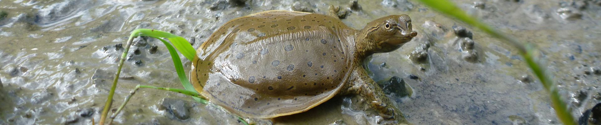
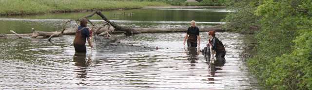
A great deal of research is being done on species at risk in the Sydenham River. The river has been surveyed very carefully for mussels by researchers wading in the river and collecting mussels by hand. The mussels are identified, measured and counted and then placed back into the river. Most species are found in riffle areas – shallow, fast moving water. Fish are sampled using seine nets, traps and a technique called electrofishing. This involves temporarily stunning the fish with an electric charge. The fish float to the surface, are identified and released unharmed. Research work is being undertaken by the National Water Research Institute, University of Guelph, Royal Ontario Museum, Department of Fisheries and Oceans, Ontario Ministry of Natural Resources and the St. Clair Region Conservation Authority.
Header Environmental Monitoring

2017-18 Project: Brown Creek Riparian Buffer Analysis

The purpose of the project was to assess the status of the riparian zone in the Brown Creek subwatershed and to report on quantity and quality of riparian buffers. The specific intent of the project was to identify riparian zones with a significant lack of vegetation, in an effort to target and guide future stewardship potential. The Authority undertook this project in partnership with the Ontario Ministry of Agriculture, Food and Rural Affairs (OMAFRA).

Conservation Services

  • Tree Planting Woodlot Services
  • Environmental Monitoring
  • Habitat Restoration Projects
  • Grants for Landowners
  • Invasive Species

Links

  • Order Trees
  • West Ipperwash Dynamic Beach Assessment
  • West Ipperwash Development Guidelines
  • West Ipperwash Shoreline Management Areas Map
  • West Ipperwash Dynamic Beach Brochure
  • West Ipperwash FAQ

About Us

The St. Clair Region Conservation Authority is located in southwestern Ontario and includes the Sydenham River watershed and smaller watersheds draining directly into southern Lake Huron, the St. Clair River, and northeastern Lake St. Clair.

The Conservation Authority implements programs to reduce the risk to life and property from flooding and erosion; water and land stewardship; forestry; wildlife habitat creation and outdoor recreation.

Partner Links

  • Conservation Ontario
  • Thames-Sydenham & Region Source Protection Area
  • Healthy Lake Huron
  • Sydenham River Website
  • St. Clair River Sediment Management Project
  • Friends of the St. Clair River
  • Forest Gene Conservation Association
  • Lake St. Clair Canadian Watershed Management Plan
  • Ontario Trillium Foundation

Connect with us!

  • St. Clair Region Conservation Authority
  • 205 Mill Pond Cres., Strathroy ON N7G3P9
  • 519-245-3710
  • 519-245-3348
  • stclair@scrca.on.ca

© 2026 · St. Clair Region Conservation Authority

  • Home
  • Accessibility
  • Privacy
  • Director Access
  • Foundation Access
  • WM