Highlights:
- Water levels starting to rise across the watershed
- 50 to 80 mm of precipitation over the next 48 hours
- Slippery stream banks
- Road closures anticipated
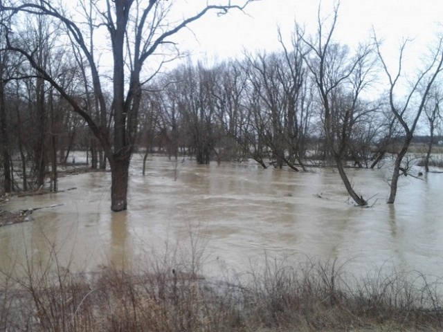
With warm temperatures across the region this weekend, water levels on the Sydenham River and its tributaries are rising moderately.
The precipitation forecast for today, Tuesday and Wednesday call for accumulations between 50mm and 80 mm. The existing snowpack was measured to be equivalent to near 40 mm of water in the watershed. Ice conditions on the lower reaches of Sydenham remain stable.
Water levels on the Sydenham River and its tributaries will further continue to rise and will remain high and near top of the bank on Sydenham River for the next several days. Localized flooding at parks in communities such as Strathroy and Petrolia, as well as farm fields throughout the region can be expected to continue for the next few days.
Ice conditions will continue to deteriorate throughout the watershed with significant thickness in the lower reaches of the Sydenham River. When this ice breaks up, ice jams are very possible and minor flooding will occur as a result. Flooding is expected to be minor in nature, and traditional floodplain areas are expected to be inundated with water for the next several days.
Road closures can be expected if the forecast rain materializes. In St. Clair Township, Waterworks Road north of Courtright Line and Pretty Road south of Stanley Line. In Enniskillen Township, Black Ash Road south of Petrolia Line and Fairweather Road south of Rokeby Line could be closed later in the week.
Municipal emergency response staff and road superintendents should monitor local conditions closely.
Residents are reminded to avoid watercourses and flooded areas due to saturated and slippery banks as well as the danger of swift moving water.
The St. Clair Region Conservation Authority will monitor the flood condition of the watersheds in the region and will provide warnings to municipal officials and media in the event conditions develop which could result in the potential of flooding.
This message will remain in effect until Tuesday, February 20, 2018 unless otherwise updated.