

• About
    • Mission / Vision Statement
    • Governance / Board of Directors
    • Board Meeting Packages
    • Area of Jurisdiction
    • Publications/Forms
    • Events
    • Tender Documents
    • Employment Opportunities
    • Accessibility
    • News & Blog
    • SCRCA Staff Directory
    • Service Disruptions
    • Contact Us
  • Permits & Planning
    • Introduction
    • Property Inquiry
    • Map Your Property
    • Regulations Permits
    • Drainage Act Project Review
    • Plan Input and Review
    • Policies and Guidelines
    • Fee Schedule
  • Water Management
    • Flood Notices
    • Flood Notice Types
    • W. Darcy McKeough Floodway
    • Low Water Response
    • Riverbank & Shoreline Protection Development
    • Erosion Control Projects
    • Great Lakes and Connecting Channels
  • Watershed Services
    • Tree Planting / Woodlot Services
    • Environmental Monitoring
    • Habitat Restoration Projects
    • Grants for Landowners
    • Invasive Species
  • Conservation Lands
  • Education
  • Foundation
    • About the SCRCF
    • Donate to our Foundation
    • Planned Giving
    • Memorial Forests
    • Sponsors
    • Land Donations
    • Scholarships
    • Green Meetings
  • Contact Us
St. Clair Region Conservation AuthoritySt. Clair Region Conservation Authority
Flood Status NORMALLow Water Status Level 1
  • About
    • Mission / Vision Statement
    • Governance / Board of Directors
    • Board Meeting Packages
    • Area of Jurisdiction
    • Publications/Forms
    • Events
    • Tender Documents
    • Employment Opportunities
    • Accessibility
    • News & Blog
    • SCRCA Staff Directory
    • Service Disruptions
    • Contact Us
  • Permits & Planning
    • Introduction
    • Property Inquiry
    • Map Your Property
    • Regulations Permits
    • Drainage Act Project Review
    • Plan Input and Review
    • Policies and Guidelines
    • Fee Schedule
  • Water Management
    • Flood Notices
    • Flood Notice Types
    • W. Darcy McKeough Floodway
    • Low Water Response
    • Riverbank & Shoreline Protection Development
    • Erosion Control Projects
    • Great Lakes and Connecting Channels
  • Watershed Services
    • Tree Planting / Woodlot Services
    • Environmental Monitoring
    • Habitat Restoration Projects
    • Grants for Landowners
    • Invasive Species
  • Conservation Lands
  • Education
  • Foundation
    • About the SCRCF
    • Donate to our Foundation
    • Planned Giving
    • Memorial Forests
    • Sponsors
    • Land Donations
    • Scholarships
    • Green Meetings
  • Contact Us

Flood Watch – January 26, 2024 – Event 2, Bulletin 2

Flood Watch – January 26, 2024 – Event 2, Bulletin 2

January 26, 2024

Road Flooding

Flood Watch

Highlights:

    • Overnight rainfall amounts of 25 to 35 mm of rain
    • Saturated soils; increased runoff and ponding
    • Elevated water levels, potential for flooding
    • Road closures are expected

Environment Canada has issued a special weather statement for the region; overnight rainfall amounts of 25 to 35 mm of rain across the watershed have caused water levels to be elevated. Unseasonably warmer temperatures are expected to continue throughout the weekend and into next week. River flows are expected to be elevated through the weekend with possible localized flooding in floodplain areas and areas of poor drainage as a result of recent rainfall and snow melt.  

Runoff into watercourses will lead to an increase water levels, which has the potential to elevate levels into natural floodplain areas, parks and farm fields. Soils are expected to be saturated from the rain and could contribute to ponding, increased runoff into watercourses, and possible increased erosion and seepage issues.   

As water levels continue to rise, the following roads may become impacted: 

      • Stanley Line between Kimball Road and Waubuno Road 
      • Pretty Road north of McCallum Line 
      • Waterworks Road north of Courtright Line 
      • Tefler Road between Courtright Line and Moore Line 

Individuals are reminded to avoid watercourses and flooded areas due to dangerous conditions, slippery banks and cold, swift moving water. Children and pets should be kept away from the water.  

The Conservation Authority continues to monitor watershed conditions and will issue advisories to municipalities and media should flood issues arise.  

Municipal emergency response staff and road superintendents should monitor local conditions closely. 

This message will remain in effect until Monday, January 29, 2024, unless otherwise updated. 
News & Blog

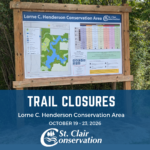
  • Picture of the Lorne C. Henderson Trail Sign with information regarding the trail closures underneath it.Trail Closures – Lorne C. Henderson Conservation Area – October 19th to 23rd
    October 18, 2026
  • Tyson Lozon (right) is awarded with the A.W. Campbell Memorial Scholarship by St. Clair Region Conservation Authority Chair, Greg Grimes (left).St. Clair Region Conservation Authority Celebrates 2026 Conservation Scholarship Recipients
    July 21, 2026
  • Four people standing beside the Bradshaw Conservation Lands signTTLT and SCRCF Host Recognition Event at Bradshaw Conservation Lands
    June 2, 2026
  • Scholarships Available through the St. Clair Region Conservation Authority
    May 1, 2026
  • A woman standing in a forest with blue tubing attached to treesSCRCA Hosts A.W. Campbell Maple Syrup Festival March 21 – Alvinston Firefighters Association to Hold Pancake Breakfast March 21 and 22
    March 9, 2026

Regulations

  • Permits
  • Apply for a Permit
  • Drainage Act Project Review
  • Legal Inquiry

About Us

The St. Clair Region Conservation Authority is located in southwestern Ontario and includes the Sydenham River watershed and smaller watersheds draining directly into southern Lake Huron, the St. Clair River, and northeastern Lake St. Clair.

The Conservation Authority implements programs to reduce the risk to life and property from flooding and erosion; water and land stewardship; forestry; wildlife habitat creation and outdoor recreation.

Partner Links

  • Conservation Ontario
  • Thames-Sydenham & Region Source Protection Area
  • Healthy Lake Huron
  • Sydenham River Website
  • Friends of the St. Clair River
  • Forest Gene Conservation Association
  • Lake St. Clair Canadian Watershed Management Plan
  • Ontario Trillium Foundation

Connect with us!

  • St. Clair Region Conservation Authority
  • 205 Mill Pond Cres., Strathroy ON N7G3P9
  • 519-245-3710
  • 519-245-3348
  • stclair@scrca.on.ca

© 2026 · St. Clair Region Conservation Authority

  • Home
  • Accessibility
  • Privacy
  • Director Access
  • Foundation Access
  • WM
Prev Next