Conservation Authorities and Living Along Lake Huron’s Shoreline
St. Clair is a local watershed management organization, incorporated under the Conservation Authorities Act of 1946. We are one of 36 Conservation Authorities across Ontario!
Conservation Authorities have a wide range of programs and services from education programs, to trails and recreational opportunities in conservation areas, to regulations and planning.
Did you know that Conservation Authorities and Municipalities are mandated by the Province of Ontario to regulate development in and around waterways? When considering our regulations and permitting, we must consider the risk of erosion, flood, and Lake Huron’s dynamic beaches.
Dynamic Beaches are beaches that undergo continuous change due to natural erosion, variable lake levels, and storm events. No new development can be built within the dynamic beach hazard limit. Now, we say new because there were homes and cottages already existing when those regulations came into force and therefore these properties do not have to be removed. If a landowner who has an existing property would like to build or renovate, they should still reach out to St. Clair Region Conservation Authority so we can work together.
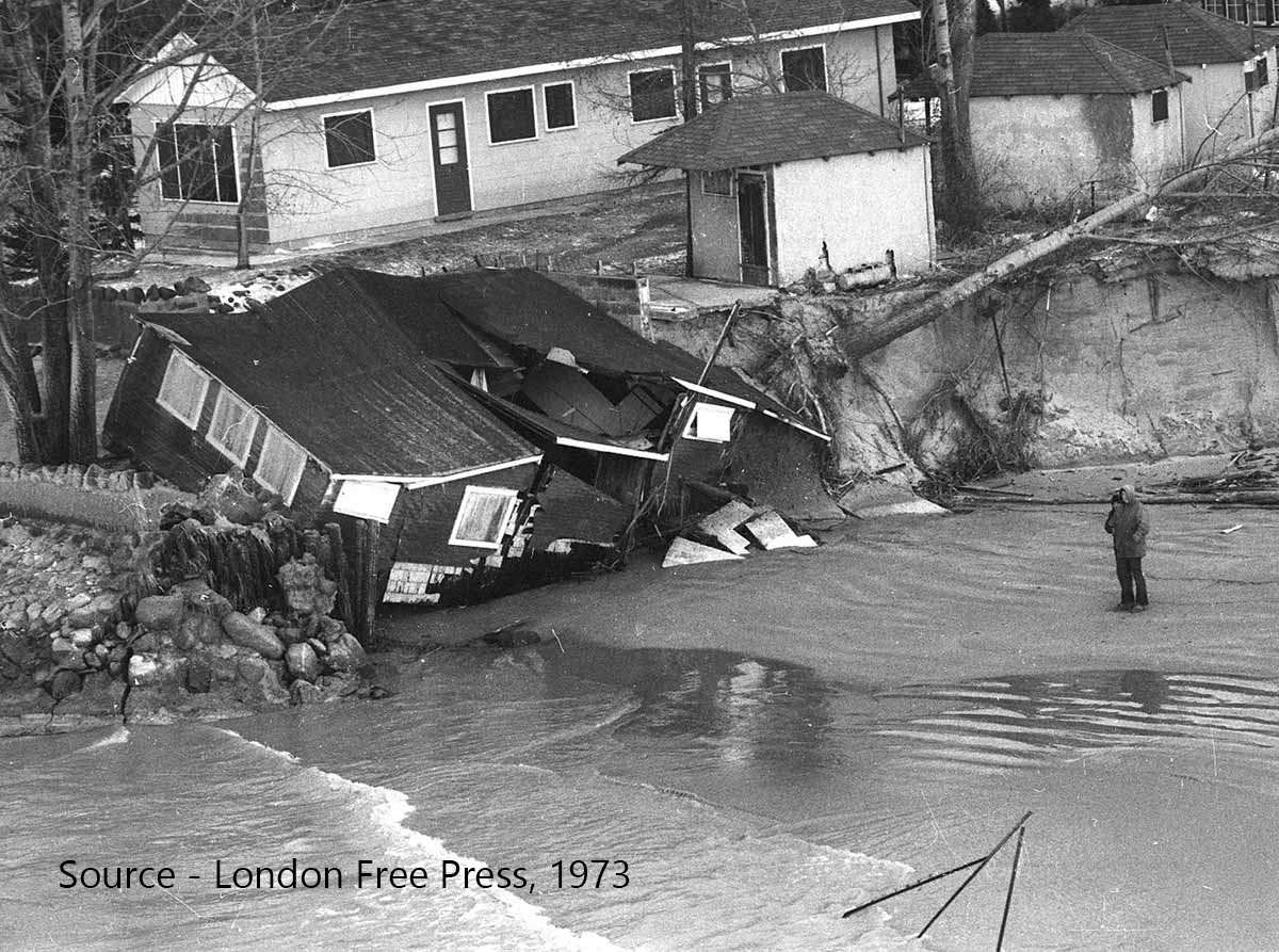 So, what does all this have to do with Conservation Authorities? Conservation Authorities, or CA’s, regulate development and activities in or adjacent to river and stream valleys, Great Lakes and inland lake shorelines, watercourses, hazardous lands, and wetlands to ensure public safety through a permitting process. SCRCA and all Ontario conservation authorities are science-based, non-partisan public sector organizations that review permit applications consistently through the requirements set forth under section 28 of the Conservation Authorities Act.
Conservation Authorities regulate lands containing natural hazards and wetlands at the watershed level because natural systems cross municipal and property boundaries. Our role is to protect and conserve the natural features in the St. Clair watershed and to protect people and property from natural hazards like flooding and erosion. Since 1956, Ontario’s conservation authorities have defined and defended floodplains to ensure public safety and property protection.
Learn more about Conservation Authorities by clicking the links below:
About Conservation Authorities – Conservation Ontario
VIDEO – What do Conservation Authorities Do? – Learn with Ranger Em
What Exactly is Happening along the Lake Huron Shoreline?
Good question! The answer is – a lot!
It all starts 10,000 years ago when the Lake Huron bluffs were created by glaciers moving along and carving deep trenches along our landscape. The bluffs are made of silt, clay, sand, or small rocks and as the water moves and crashes into the bluffs, it takes small amounts of the soil and rock with them. The soil and rock move along the shoreline, eventually creating the sandy beaches we love and dune habitats that our wildlife depend on. Erosion is a completely natural process and necessary for beach ecology, and, without it, Lake Huron’s sandy beautiful beaches wouldn’t exist.
The shoreline of Lake Huron is dynamic; always changing and waiting for us to catch up. There is a mindset surrounding erosion that it is a negative thing; however, when discussing one of the Great Lakes, we must realize this mighty system will continue working as it is. When considering Lake Huron and its ecosystem, erosion is beneficial and necessary. Our beach and dune systems rely on bluff erosion and other shoreline processes in order to exist. In turn, our beaches then protect our shoreline and properties from storm waves and erosion.
Learn more about Lake Huron bluffs, beaches, dunes and shoreline processes in general, by visiting the following websites!
Lake Huron Beaches and Dunes – Lake Huron Coastal Centre
Lake Huron Bluffs and Gullies – Lake Huron Coastal Centre
Lambton Shores Tributaries Management Plan
Buying Property Along Shoreline
Interested in purchasing property along the Lake Huron shoreline? It’s important to work with your local Conservation Authority before purchasing a property. Ecological factors like erosion, flooding, and unstable soils are a fact of life on any shoreline and though we can’t completely stop them, we can learn to understand and assess them and their impact on our properties.
A few quicks steps to take if you’re interested in a shoreline property:
-
-
-
- Step 1 – Check to see if the property is regulated (click HERE for SCRCA regulation limits).
- Step 2 – Submit a completed property inquiry form.
-
-
The property inquiry process allows staff to do a site visit (if necessary) and then tailor mapping and a letter specific to your inquiry. The more specific you can be, the better. This would allow us to assess the hazards and get back to you with a written response and mapping, so you understand the requirements on the property prior to purchasing.
 The SCRCA is here to help guide you, it is never too early to talk to us to get the information you need and the required permits!
For more information on the SCRCA’s property inquiry process visit the links below:
SCRCA Property Inquiry Process
VIDEO – Buying Property Along the Shoreline – What You Need to Know
Lake Huron Shoreline Management Plan Update (2011) – Baird & Associates Coastal Engineers Ltd.
SCRCA Wetland Regulation Policy
Building Along Shorelines
Interested in building or adding development to your property?

It’s always best practice to reach out to the local Conservation Authority first to see if your property is within a regulated area and if there are any permits necessary for the development. As mentioned above, this makes it easy to understand, assess and mitigate the risks that could affect your property.
Follow these steps when looking to build along the shoreline:
-
-
-
- Download and complete our permit application form,
- Provide a sketch showing the proposed location of the new structure, including the distance to the existing structures on the property,
- Attach the construction plans/drawings, including foundation/footing details,
- Depending on your project, you may need other technical documents (e.g., coastal engineering report, survey, etc.)
-
-
The SCRCA is here to help guide you with your building goals and ensure responsible development along the Lake Huron shoreline. It is never too early to talk to us to get the information you need and the required permits!
Additional Resources:
SCRCA Online Mapping Tool – Regulation Limits
VIDEO – Building Along the Shoreline – What you Need to Know
Living with Erosion
As mentioned previously, erosion is a natural and common process along our shorelines, but how do we live with it? One role of a Conservation Authority is to help you enjoy Lake Huron while keeping you safe by working together to mitigate the risks of erosion.
One of the best things you can do as a landowner is to check your shoreline property regularly, looking for signs of erosion.
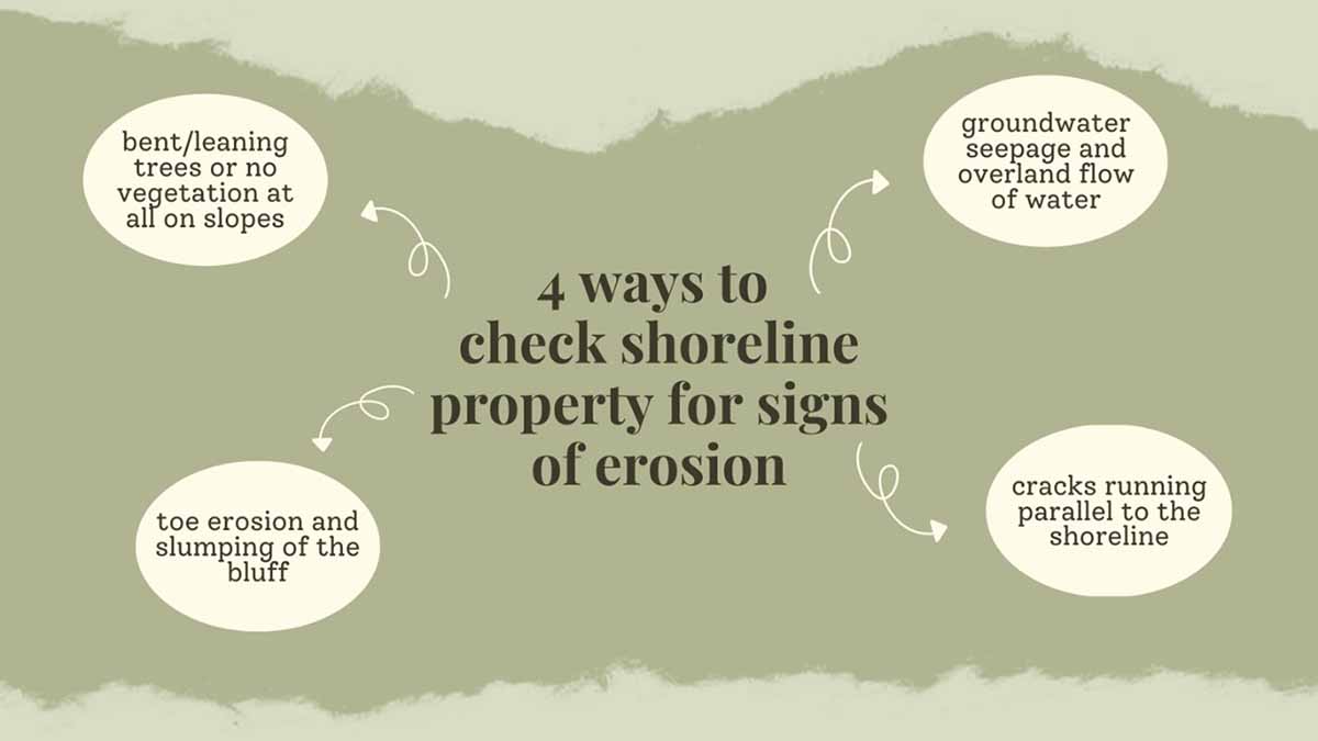
Now that we know the signs to look for, let’s discuss steps we can take to reduce the risk of erosion and build shoreline resiliency.
Bluffs along Lake Huron owe much of their stability to vegetation that binds soil, making it more resistant to erosion. Particularly, woody vegetation enhances the stability of slopes. This is due to the complex root network formed by native trees, shrubs, and grass species that holds soil together and increases the resistance of soil to slipping, sliding, and washing away along the shoreline.
Native vegetative species found in Lake Huron’s coastal ecosystems have evolved with shoreline processes and are extremely important to the resiliency of Lake Huron’s coastline. Contact Jeff Sharp, Conservation Services Specialist at [email protected] if you’re interested in planting trees on your shoreline property or learning more about other options available to naturalize and stabilize your shoreline.
Click on the links below for more information:
Lambton Shores Tributaries Management Plan
Stewardship Plans and Guides – Lake Huron Coastal Centre
Lake Huron Coastal Bluff Native Plants Guide – Lake Huron Coastal Centre
Celebrate “Love Your Greats Day”
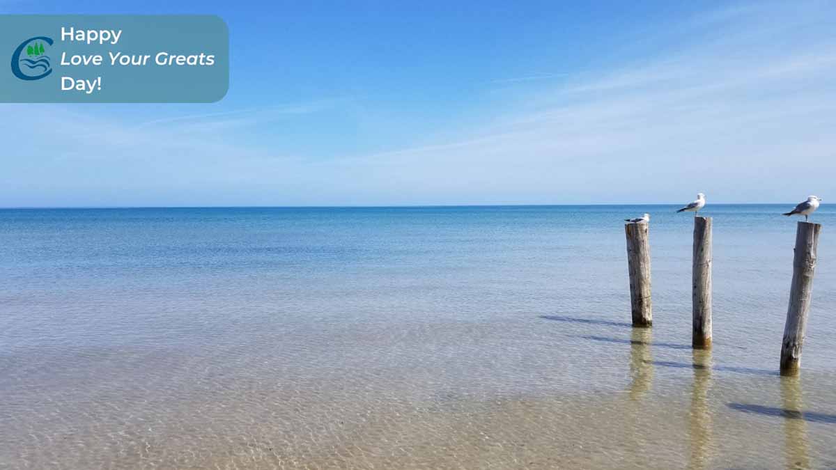
Saturday, August 13th is “Love Your Greats Day” and we would be remiss if we didn’t finish off this post by celebrating the Lake we’ve been discussing. The staff at St. Clair Conservation loves and appreciates being able to work alongside such a beautiful lake and shoreline. Thank you for celebrating “Love your Greats” with us! We hope you enjoyed learning more about erosion and shoreline processes and how the SCRCA helps shoreline residents live safely and in harmony with the dynamic and complex system along the Lake Huron shoreline.
Enjoy the weekend and the nice weather by taking a trip to one of Lake Huron’s beautiful beaches!
Find a beach location and local events at:
Municipality of Lambton Shores – Beaches