-
- Water levels have peaked and are now falling
- Rainfall in the forecast through to Wednesday
- Water levels anticipated to react more quickly with increased runoff
- Saturated soils, ponding, and flooding in floodplain areas
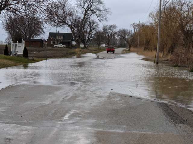
- Several roads continue to be impacted by flooding
Water levels across the watershed remain high and into natural floodplain areas after receiving upwards of 70 mm of rain late last week. Forecasts are calling for variable amounts of rain over the next three days, with 15-30 mm possible this evening into Tuesday morning, followed by an additional 10-30 mm both Tuesday and Wednesday.
Water levels across the watershed have now peaked and are beginning to recede. As the region begins to receive more rainfall, saturated soils from last week’s rain will contribute to increased runoff into watercourses. Water levels will respond more quickly to the rain under these saturated conditions and are likely to elevate to levels similar to those this past weekend, should the higher forecasts materialize.
-
- Stanley Line between Kimball and Waubuno Road
- Waubuno Road between Bickford Line and Oil Springs Line
- Pretty Road north of McCallum Line
- Waterworks Road north of Courtright Line
- Telfer Road between Courtright Line and Moore Line
The Conservation Authority continues to monitor watershed conditions and will issue advisories to municipalities and media should flood issues arise.
Municipal emergency response staff and road superintendents should monitor local conditions closely.
This message will remain in effect until Wednesday, April 5, 2023 at 12pm unless otherwise updated.