Highlights:
- 30-40 mm of precipitation received in the past 24 hours throughout the region
- Fast flowing water and slippery banks
- Water levels to rise over next few days
- Additional 10-15 mm precipitation today
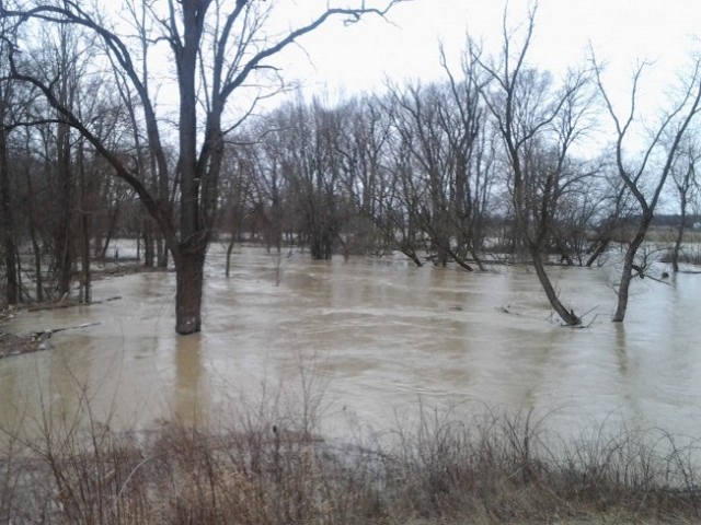
Extensive precipitation over the past 24 hours has resulted in high flows in all watercourses. Water levels on the Sydenham River and its tributaries will be pushed to top of bank over the next few days. Additional precipitation of 10mm to 15mm is forecast for today, as the ground is saturated, this additional precipitation will result in immediate run off into rivers and streams. This will result in consistently high water levels into the weekend. Drains, floodplains and smaller watercourses in upstream areas will experience localized flooding in some areas. Conditions are anticipated to moderate early next week once flows return to normal conditions
While flooding is anticipated to be minor in nature, traditional floodplain areas may become inundated with water over the next few days.
The Conservation Authority continues to monitor watershed conditions and will issue advisories should flood issues arise. Residents are reminded to avoid watercourses and flooded areas due to slippery banks, cold and swift moving water. Parents in particular are urged to keep their children away from floodplain areas.
Municipal emergency response staff and road superintendents should monitor local conditions closely.
The St. Clair Region Conservation Authority will monitor the flood condition of the watersheds in the region and will provide warnings to municipal officials and media in the event conditions develop which could result in the potential of flooding.
This message will remain in effect until Monday April 3, 2017 unless otherwise updated.